Each area shown on this map is either a Special Area of Conservation or Special Protection Area designated for the protection of marine habitats or species. These types of protected areas form a network of sites across Europe, termed the Natura 2000 network, aimed to maintain and restore nature.
According to EU law, any activity likely to affect a Natura 2000 site should be assessed before being authorized, to verify that it does not impact the integrity of the species and habitats protected by the site. If an activity is found to have a likely impact, it should not go ahead.
However, Ireland is not respecting its obligations under EU nature laws.
Despite the known impacts of fishing and aquaculture on the protected habitats and species, these activities have been allowed to go ahead for decades with little management. The EU is taking Ireland to court (and not for the first time) for this failure to adequately protect its Natura 2000 network.
Do you know
where I like to fish?
In Marine Protected Areas!

Did you say Marine Protected Areas?


About
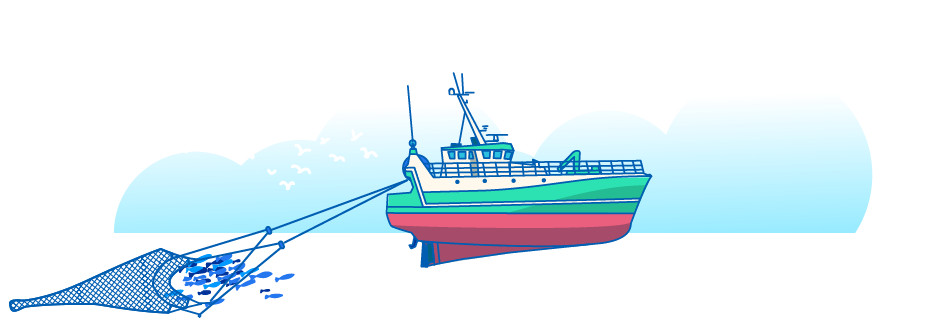
What kind of fishing are we talking about?
Pelagic trawls
In pelagic trawling, a large cone-shaped net is dragged through the open sea to catch fish that swim in schools, such as Herring, Mackerel or Sprat.
What’s the problem?
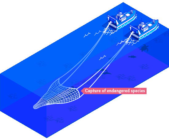
While this fishery often targets large shoals of single species, sometimes non-target species such as dolphins, sharks or turtles, are also caught which often leads to death. The catch of non-target species is termed bycatch.

Bottom trawls:
A vessel using bottom trawls drags a net over the seafloor in order to catch bottom-dwelling fish such as cod, sole or hake or crustaceans such as the dublin bay prawn.
What’s the problem?
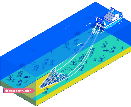
This method of fishing is not very selective. Some trawlers can carry nets the size of a football field, catching everything in their path including vulnerable non-target animals such as sharks and rays, corals, or seapens.
Dredges:
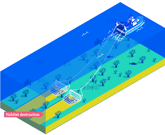
Instead of a net, a dredger drags a metal cage with teeth over the seafloor to catch molluscs such as scallops, oysters or clams. Sometimes this cage is hydraulic and penetrates deep into the sediment to catch animals that live in burrows in the seafloor.
What’s the problem?
The heavy cage acts as a rake on the seafloor, causing severe damage to the plants and animals that live in or on the seabed. A dredged seafloor ecosystem is severely altered and may take many years to recover.
Gillnets:
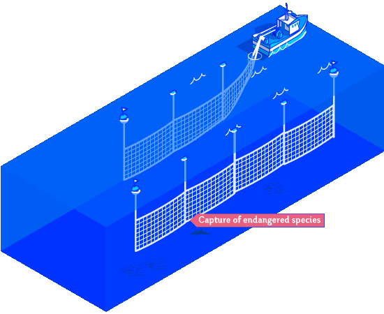
A gillnet is a type of static gear suspended in the water, anchored to the bottom and fitted with floats to catch fish that get trapped as they accidentally swim into it.
What’s the problem?
Many other non-target animals can get trapped while these suspended nets are deployed in the water. Bycatch can include endangered shark species, seals and dolphins.
Longlines:
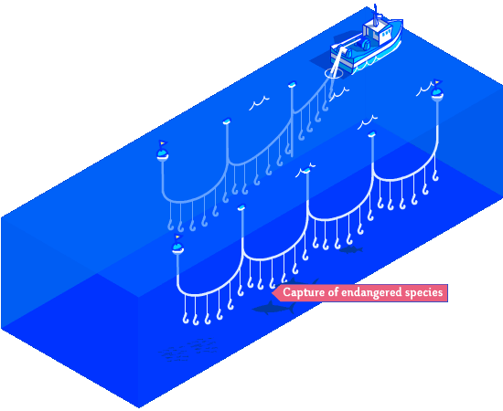
Commercial longlines can have thousands of baited hooks attached to them to catch many types of fish, such as hake.
What’s the problem?
The bait also attracts other non-target species such as sharks, turtles or seabirds. It is estimated that over 50,000 birds are caught annually in Ireland in the hake fishery alone.
Why do we need marine protected areas?
Ireland’s seas are severely degraded compared to historical conditions. Marine protected areas are a proven way to regenerate life in our ocean. By closing off areas to harmful human activities, we are allowing nature to recover there. This has proven benefits for biodiversity, the fisheries and tourism sectors, and even climate change mitigation and adaptation. Choosing the right areas and the right management, MPAs are a win-win for nature, climate and people.
More information
What’s the situation in Ireland?
Because of the incredible benefits that marine protected areas bring, Ireland has committed to designating at least 30% of its vast waters as MPAs by 2030. However, today Ireland protects merely 2.1% of its waters, which is among the lowest rates in Europe. In addition, the areas that are designated are not actively managed to reduce human impacts, which means nature does not profit from the designation. In order to make MPAs work, they need to be free from industrial fishing and other harmful activities, be actively managed with public participation, well-resourced, and ecologically coherent. Ireland has a lot of work ahead in order to achieve the 30% target, and it will not be possible without strong political will and ambition.
How was the map created?
Fishing effort data was downloaded for each protected area in the south-west region of Ireland using the Global Fishing Watch Marine Manager Portal.
The suggested gear types from Global Fishing Watch were cross-checked with the European Fleet Register, to ensure that only vessels using the desired gear types were included.
All maps were created using QGIS 3.6.1.
Attention!
These data underestimate the total fishing activity:
1. These data are based on the automatic identification system (AIS). This is a tool for geolocation of vessels, which increases the safety of navigation and the efficiency of maritime traffic management. However, in certain circumstances, ships may turn off their AIS. In these cases, they are no longer geolocated. Their fishing effort is not counted in the data provided by Global Fishing Watch, so it does not appear in this analysis.
2. Only vessels over 15 meters are required to be equipped with AIS technology. Many boats under 15 metres are therefore not included in the analysis, which means that the total fishing activity in the Irish inshore region is undoubtedly much higher than it appears on this map.